The Longitude Problem: Why an Accurate Clock Changed Ocean Navigation
Learn the time-difference logic behind longitude and why John Harrison's marine timekeepers transformed navigation at sea.
Reviewed October 10, 2026. Dates and instrument history are checked against Royal Museums Greenwich and UK Parliament resources.
Latitude can be estimated from the height of celestial objects above the horizon. Longitude is harder because it describes east–west position on a rotating Earth. Sailors needed a dependable reference connecting their local observation to time at a known meridian. The conceptual answer was simple: compare local time with reference time. The engineering answer required a clock that remained accurate through motion, humidity, temperature changes, and a long voyage.
John Harrison's decades of work on marine timekeepers became the most famous solution. His story is not a lone flash of invention replacing astronomy overnight. It combines legislation, prizes, craft knowledge, repeated prototypes, testing, institutional disagreement, and eventual methods that could be reproduced by other makers.
1. Earth turns time into angle
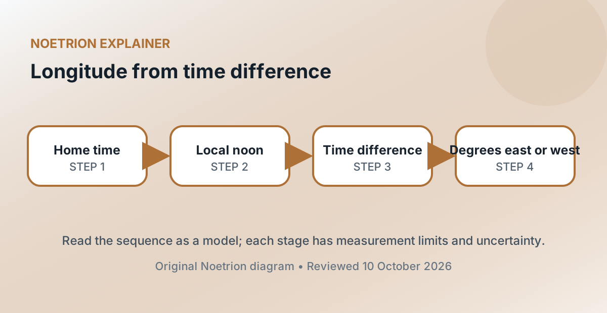
Earth rotates approximately 360 degrees in 24 hours, or 15 degrees per hour. If local solar noon occurs when a reference clock reads 14:00, the location is roughly two hours, or 30 degrees, west of the reference meridian. If local noon occurs while reference time is 10:00, the location is roughly 30 degrees east.
This simplified calculation hides practical work: determining local time from observations, keeping reference time, correcting tables, and measuring on a moving ship. Yet it explains why clock error becomes position error. Four minutes of time correspond to about one degree of longitude. At the equator, one degree spans roughly 111 kilometres; the east–west distance represented by a degree narrows toward the poles.
2. Navigation made error consequential
Dead reckoning estimated position from direction, speed, and elapsed time. Small errors accumulated. Currents and winds moved ships differently from their assumed path. A longitude error could place a ship on the wrong side of a reef or cause a captain to search for land where none existed.
Several proposed methods used celestial observations. Lunar-distance techniques compared the Moon's position with stars and required accurate astronomical tables plus difficult observations and calculations. The timekeeper method carried the reference meridian's time aboard ship. Both approaches contributed to navigation, and navigators often valued independent checks.
3. The Longitude Act created an organized challenge
In 1714, the British Parliament established rewards for practical methods of determining longitude at sea and created the Board of Longitude. The largest reward was associated with accuracy within half a degree after a voyage to the West Indies. The act turned a widely recognized problem into an institutional program of proposals, trials, evidence, and payment decisions.
| Element | Why it mattered |
|---|---|
| Stated accuracy | Made success testable rather than rhetorical |
| Sea trial | Required performance in the actual environment |
| Board review | Connected evidence to staged rewards |
| Disclosure and replication | Encouraged a method others could use |
The prize did not guarantee a smooth process. Standards of proof, ownership, repeatability, and institutional authority remained contested.
4. Harrison attacked the clock's environment
John Harrison, born in 1693, was a carpenter and self-taught clockmaker. Ordinary pendulum clocks were unsuitable for rolling ships, and temperature changes altered materials and lubricants. Harrison developed mechanisms intended to reduce friction, compensate for temperature, and maintain stable oscillation without a pendulum.
His first marine timekeeper, now called H1, was completed in the 1730s. H2 and H3 pursued further improvements. These machines were large and mechanically distinctive. Harrison did not merely shrink a land clock; he repeatedly reconsidered how its regulating system should behave at sea.
5. H4 changed the form of the solution
Harrison's fourth marine timekeeper, H4, looked more like a large watch than his earlier machines. It was tested on a voyage to Jamaica in 1761–1762 and performed well enough to demonstrate that portable timekeeping could meet demanding longitude requirements. Further trials and scrutiny followed.
The famous dispute concerns recognition and payment. The Board required additional evidence and disclosure. Harrison received money in stages rather than a simple immediate award of the full headline prize. In 1773, Parliament granted him a further payment after the intervention of King George III. Describing this as one moment of “winning the prize” erases the long argument over conditions and proof.
6. Replication mattered as much as a prototype
A unique instrument can prove possibility without solving fleet-scale navigation. The methods had to be documented and reproduced at a price ships could bear. Watchmaker Larcum Kendall produced K1 as a copy of H4; it sailed with James Cook. Other makers, including Thomas Mudge and John Arnold, advanced precision timekeeping and manufacture.
The word chronometer later referred to a precision timekeeper meeting performance standards. Wider adoption depended on production, maintenance, rating, observatory checks, and nautical practice. Navigation transformed through a system of instruments, tables, training, and institutions—not through hardware alone.
7. Reference meridians were also social infrastructure
A clock aboard ship needs a defined reference time. Greenwich became central through British navigation and astronomical practice, but the international prime meridian was not universally fixed until the International Meridian Conference of 1884 selected Greenwich for the shared reference used by most participants.
Longitude therefore combines physics with coordination. Earth supplies the rotation; societies choose a common zero and maintain time standards. Modern satellite navigation uses atomic time, radio signals, orbital models, and relativistic corrections, yet the underlying need remains familiar: position comes from comparing precise measurements against an agreed reference.
8. The durable lesson is about measurement systems
Harrison's achievement shows that a theoretical relationship becomes useful only when measurement survives real conditions. A laboratory clock that fails under motion is not a navigation solution. A successful voyage is persuasive but still leaves questions of replication and routine use.
The history also warns against telling invention as a single heroic instant. Incentives framed the problem; artisans built and revised mechanisms; astronomers produced alternative methods and reference data; sailors tested devices; institutions judged claims; manufacturers spread the capability. Accurate longitude emerged from all of them.